Ice Age Model

freethisone

Re: Ice Age Model
« Reply #375, on February 27th, 2015, 07:22 AM »Last edited on February 27th, 2015, 07:26 AM
major quake nirror of feb 27 2010

2015-02-27 13:45:05 UTC -7.34 122.52 7.0 548  Flores Sea   

will kepler law hold? what is in store for us  next march 11 2016? will jan-  2017?  1701 the number on the ship be a star trek moment?

lastly will kepler law hold here, and on feb 6 2016 we have another great quake?  ice age model gives clues, estimating a high probability of prediction based on time variable relation with ex -po star K....

2015-02-27 13:45:05 mag  7.0   Flores Sea   

7,0 strikes floral sea, after a major uptick for February :( 2015.

freethisone

Re: Ice Age Model
« Reply #376, on February 27th, 2015, 07:06 PM »
Volcanic activity worldwide 20 Feb 2015: Shiveluch volcano, Sinabung
Friday Feb 20, 2015 21:00 PM |

Ash plume from Shiveluch volcano today (MTSAT-2 image / VAAC Tokyo)
Sinabung's new lava lobe in the crater (image: Leopold Kennedy Adam ‏@LeopoldAdam / twitter)
Shiveluch (Kamchatka): An eruption today produced an ash plume that rose to estimated 25,000 ft (7.5 km) altitude, detected on infrared satellite imagery (VAAC Tokyo).
This could have been an explosion at the dome or an ash plume from a pyroclastic flow due to a partial collapse event, but visible webcam images are not clear to distinguish this.

Sinabung (Sumatra, Indonesia): A high-level eruption at 15:22 UTC (22:22 local time) with an ash plume rising to 45,000 ft (15 km) altitude was reported by Darwin VAAC short time ago.
If this report turns out to be true (so far, no other evidence available), it would mean that a major vulcanian to sub-plinian explosion is occurring or has occurred as a surprise.
...20 Feb:
Pyroclastic flows continue to occur, as a new lobe of viscous lava is growing in the summit crater. The collapses during the past 2 weeks and their associated flows have strongly changed the morphology of the crater, removing most of the existing dome, while this is now being replaced by fresh material.
A larger flow on Wednesday night reached 4 km distance, further than all of the previous ones in recent months. It reached the evacuated villages of Suka Meriah where it burnt houses. Fortunately, no victims were reported as people from the place had been relocated permanently. Ash fall occurred in Berastagi town 30 km away.
Volcano Activity Summary for 20 Feb 2015:
Currently erupting:
Ambrym (Vanuatu): active lava lakes in several craters (updated 14 Aug 2013)
Aso (Kyushu): intense strombolian activity from main vent in Nakadake crater (updated 16 Feb 2015)
Bardarbunga (Central Iceland): lava lake, sporadic fountains, lava flow (updated 18 Sep 2014)
Batu Tara (Sunda Islands, Indonesia): strombolian explosions, ash plumes up to 500 m, extrusion of a small lava dome with rockfalls (updated 4 Nov 2014)
Chikurachki (Paramushir Island): ash emissions, explosions (updated 17 Feb 2015)
Colima (Western Mexico): slowly growing lava dome, occasional explosions (updated 19 Feb 2015)
Copahue (Chile/Argentina): ash venting (updated 4 Dec 2014)
Daikoku (Volcano Islands): underwater eruption discovered on 14 Dec 2014 (updated 22 Dec 2014)
Dukono (Halmahera): thermal anomaly, probably small explosive activity in summit crater (updated 12 Feb 2015)
Erebus (Antarctica): active lava lake in summit crater (updated 8 Dec 2014)
Erta Ale (Ethiopia): active lava lake in northern pit crater, active hornito with intermittend flow in southern crater (updated 11 Jan 2013)
Fuego (Guatemala): intermittent strombolian explosions (updated 19 Feb 2015)
Gamalama (Halmahera): new eruption on 18 Dec 2014 (updated 22 Dec 2014)
Ibu (Halmahera, Indonesia): stromolian and phreatomagmatic explosions (updated 14 Nov 2014)
Karangetang (Siau Island, Sangihe Islands, Indonesia): growing lava dome, incandescent avalanches (updated 5 Feb 2015)
Karymsky (Kamchatka): occasional small explosions, thermal anomaly (updated 28 Jan 2015)
Kilauea (Hawai'i): new lava flow from vents on NE flank of Pu'u 'O'o (updated 13 Aug 2013)
Kliuchevskoi (Kamchatka): strombolian activity and lava flow on summit vent (updated 19 Feb 2015)
Marapi (Western Sumatra, Indonesia): sporadic explosions (updated 27 Mar 2014)
Nasu (Honshu)
Nishino-shima (Volcano Islands, Japan): growing island (updated 19 Jan 2015)
Nyamuragira (DRCongo): active lava lake (updated 29 Nov 2014)
Nyiragongo (DRCongo): active lava lake in summit crater (updated 26 Feb 2014)
Ol Doinyo Lengai (Tanzania): effusion of natrocarbonatite lava inside the crater (updated 8 Jul 2013)
Poas (Costa Rica): phreatic explosions (updated 14 Oct 2014)
Popocatépetl (Central Mexico): degassing, sporadic explosions, slowly growing lava dome (updated 16 Feb 2015)
Rabaul (Tavurvur) (New Britain, Papua New Guinea): lava fountains, ash emissions from Tavurvur cone (updated 12 Sep 2014)
Raung (East Java): mild strombolian activity in summit crater (updated 2 Dec 2014)
Reventador (Ecuador): active lava flow no southwestern flank, intermittent explosions (updated 12 Feb 2015)
Sakurajima (Kyushu, Japan): ash venting, intermittent explosions (updated 19 Feb 2015)
Sangay (Ecuador): likely strombolian eruptions at summit crater (updated 28 Jan 2015)
Sangeang Api (Indonesia): growing lava dome & lava flow (updated 7 Jul 2014)
Santiaguito (Guatemala): small explosions from the Caliente dome and active lava flow (updated 3 Feb 2015)
Semeru (East Java, Indonesia): growing lava dome, lava flow, strombolian activity (updated 26 Nov 2014)
Shiveluch (Kamchatka): growing lava dome (updated 20 Feb 2015)
Sinabung (Sumatra, Indonesia): continuing pyroclastic flows (updated 20 Feb 2015)
Soputan (North Sulawesi, Indonesia): active viscous lava flow, explosions, rockfalls, pyroclastic flows (updated 12 Feb 2015)
Suwanose-jima (Ryukyu Islands): strombolian activity (updated 16 Feb 2015)
Tungurahua (Ecuador): moderate to strong strombolian explosions from central crater (updated 25 Sep 2014)
Villarrica (Central Chile): strombolian activity in summit crater, small lava lake (updated 17 Feb 2015)
Yasur (Tanna Island, Vanuatu): ash emissions, weak strombolian explosions (updated 14 Aug 2013)
Zhupanovsky (Kamchatka, Russia): intermittent ash emissions (updated 16 Feb 2015)

freethisone

Re: Ice Age Model
« Reply #377, on March 2nd, 2015, 08:48 PM »
Ice age model now predicts at least one or two more very powerful quakes in a very short time. up to 8.0,, 6.5 to 7.5 is more reasonable assumption.

the last 40 days produced results, now the sun is in response and should verify this relation to volcanic eruption, and crustal displacement due to external forces crossing the gap. spark discharge.  up to 7 days to see results. that puts my prediction well out of reach of simple guess work if it does indeed prove to be correct. although i have demonstrated many times this is the case.


this is my main cause as a result of time variable relation with such objects described..   cause and effect chain external net force precession torque :heart: times delta T..

freethisone

Re: Ice Age Model
« Reply #378, on March 3rd, 2015, 04:47 PM »


This is what a very powerful X class flair looks like, we all know that.. see the X-ray burst?  well that's an x class flair. so why the lie that it is a M-8 flair.

i have my reasons.. 

freethisone

Re: Ice Age Model
« Reply #379, on March 8th, 2015, 09:09 PM »
Quote from freethisone on March 2nd, 2015, 08:48 PM
Ice age model now predicts at least one or two more very powerful quakes in a very short time. up to 8.0,, 6.5 to 7.5 is more reasonable assumption.

the last 40 days produced results, now the sun is in response and should verify this relation to volcanic eruption, and crustal displacement due to external forces crossing the gap. spark discharge.  up to 7 days to see results. that puts my prediction well out of reach of simple guess work if it does indeed prove to be correct. although i have demonstrated many times this is the case.


this is my main cause as a result of time variable relation with such objects described..   cause and effect chain external net force precession torque :heart: times delta T..
day 7 is tomorrow..

freethisone

Re: Ice Age Model
« Reply #380, on March 9th, 2015, 12:06 AM »Last edited on March 9th, 2015, 12:54 AM
here we go again sun is being blotted out by object of high mass, this will continue for a few days simply look at 230 am to 330 am to watch the solar eclipse.

now as i have said this is a time variable relation, and allows ice age model to make prediction. i will look at the last time this happened and calculate what time frame i am looking at.. wow i really am that good....

Had a feeling this would happen, glad i caught it again.


the sun will be coming out soon....and u may see it again...


this happened for the last 3 or  4 years in a row...  7-18-2013 also... and if it be a 7 year tribulation, we are now on year 5...

space ship star trek 1701 or jan 1 2017 we shall see.. peace baby peace...


https://www.youtube.com/watch?v=ICHM-Ic5KlA#


the 2012 great quake occurred on april 19 i think...

so i say we are looking at great quake as early as 60 days, probably less.


march 6 2012  https://www.youtube.com/watch?v=sfpCo4yDIeA#

and again here 3-13-2011

https://www.youtube.com/watch?v=n0MwGdBD4HE#


https://www.youtube.com/watch?v=x6QWLDk8drw#ws


by the by i already captured the images before the sun went black. looks like the nasa decided not to let u see the sun re emerge this time. just stand by and wait till tomorrow. 215 am to 300 am..

freethisone

Re: Ice Age Model
« Reply #381, on March 9th, 2015, 12:57 AM »
check it out

freethisone

Re: Ice Age Model
« Reply #382, on March 9th, 2015, 11:54 PM »Last edited on March 10th, 2015, 12:51 AM
:P gotcha again B -each:P :P

freethisone

Re: Ice Age Model
« Reply #383, on March 10th, 2015, 11:58 PM »Last edited on March 11th, 2015, 12:09 AM
Got You Again Beaches at , Nasa ,U been Had again. :P :P Day 3  possibly happen 1 more day, but i doubt ill get any images tomorrow..

freethisone

Re: Ice Age Model
« Reply #384, on March 11th, 2015, 03:02 PM »Last edited on March 11th, 2015, 04:58 PM
and in scripture, the sun was blotted out from the sky for 3 days..  very very possible knowing what we have  learned...

Southern California appears to have under great stress, and may fracture any day now..   

As A result of the spark gap trigger  we finally see a X class flair..  Not the first one this week, only the first one they admit to.


http://www.spaceweather.com/images2015/11mar15/x2_red.jpg?PHPSESSID=f21iadruaeprg1ee70gk66nkj1

X2-FLARE AND RADIO BLACKOUT: All week long, sunspot AR2297 has been crackling with solar flares. Today it produced a really big one. On March 11th at 16:22 UT (09:22 PDT), Earth orbiting-satellites detected an X2-class flare, shown here in an image from NASA's Solar Dynamics Observatory:

Extreme ultraviolet radiation from the explosion ionized the upper layers of Earth's atmosphere, causing HF radio fade-outs and other propagation effects on the dayside of our planet. In the red zone of this map, ham radio operators and mariners may have noticed brief but complete blackout conditions at frequencies below 10 MHz. The disturbance has since subsided.

Natural radio emissions from the sun, which are produced by shock waves in the sun's atmosphere, suggest that a CME is emerging from the blast site at speeds exceeding 1,400 km/s (3.1 million mph)


freethisone

Re: Ice Age Model
« Reply #385, on March 11th, 2015, 09:13 PM »
Oh my, 4 storms at one time. 


Tropical Storm Report
Storm name: Olwyn (19S)
Category: Cyclone I
Position date: 2015.03.12 04:10:24
Speed: Speed of 17 km/h to 205 degrees direction
Wind speed: 111 km/h
Gust speed: 139 km/h


Tropical Storm Report
Storm name: Nathan (18P)
Category: Cyclone I
Position date: 2015.03.12 04:10:24
Speed: Speed of 2 km/h to 315 degrees direction
Wind speed: 93 km/h
Gust speed: 120 km/h


Tropical Storm Report
Storm name: Pam (17P)
Category: Cyclone V
Position date: 2015.03.12 04:10:24
Speed: Speed of 13 km/h to 170 degrees direction
Wind speed: 213 km/h
Gust speed: 259 km/h


Tropical Storm Report
Storm name: Bavi (03W)
Category: Tropical Storm
Position date: 2015.03.12 04:10:24
Speed: Speed of 13 km/h to 280 degrees direction
Wind speed: 65 km/h
Gust speed: 83 km/h


freethisone

Re: Ice Age Model
« Reply #387, on March 11th, 2015, 11:02 PM »Last edited on March 11th, 2015, 11:13 PM
Just to let every one know,

3.1
19km WNW of Eutaw, Alabama

2015-03-12 01:19:20 UTC

10.8 km

note the time, no other earthquakes have been reported anywhere in the world since this one.  By the USGS.. see list below..

its 2 am eastern this quake was a long time ago many hours..

something is up, because they are  hiding every other  quake that is going on right now.

note the time..


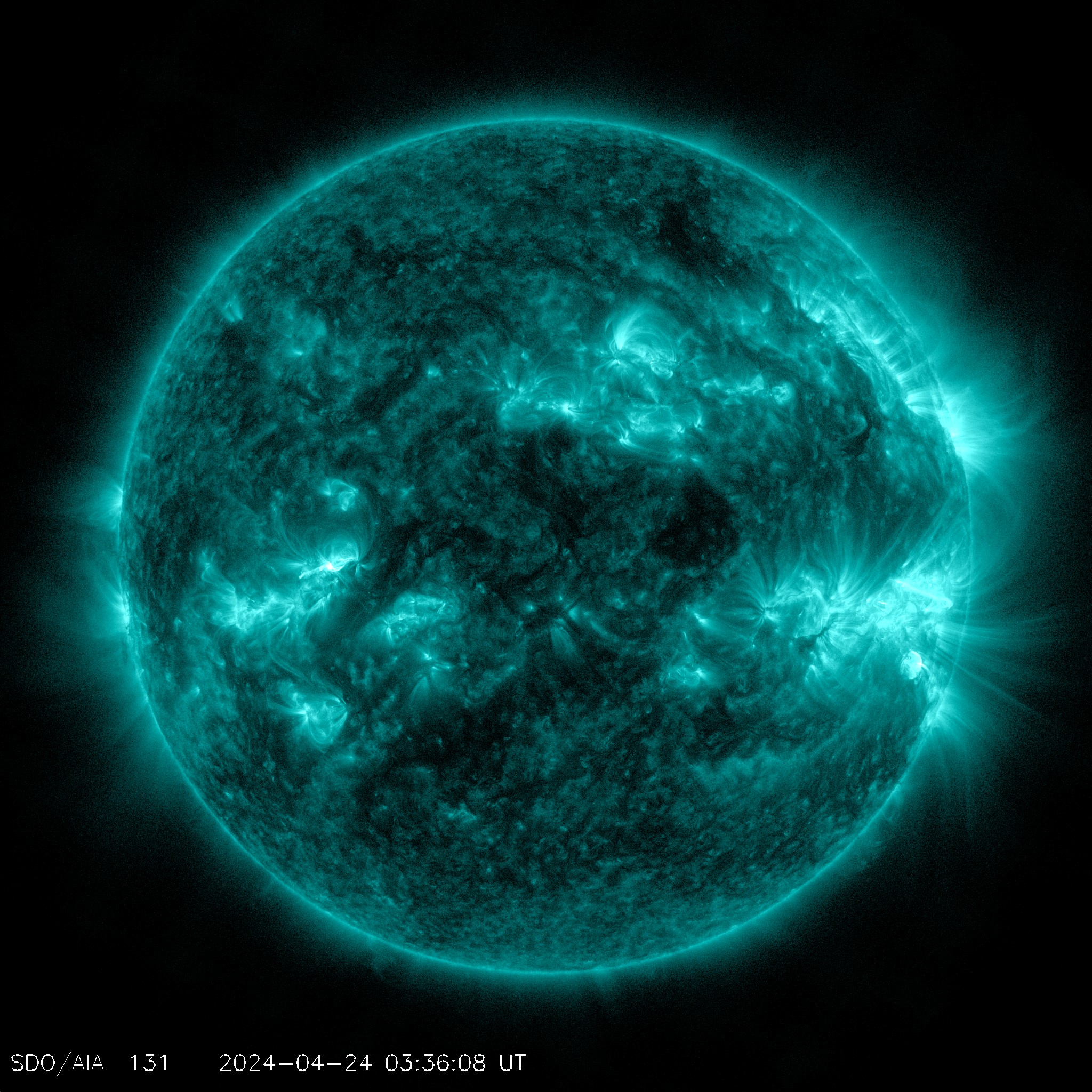
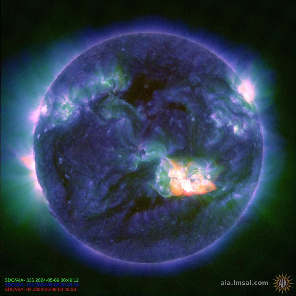
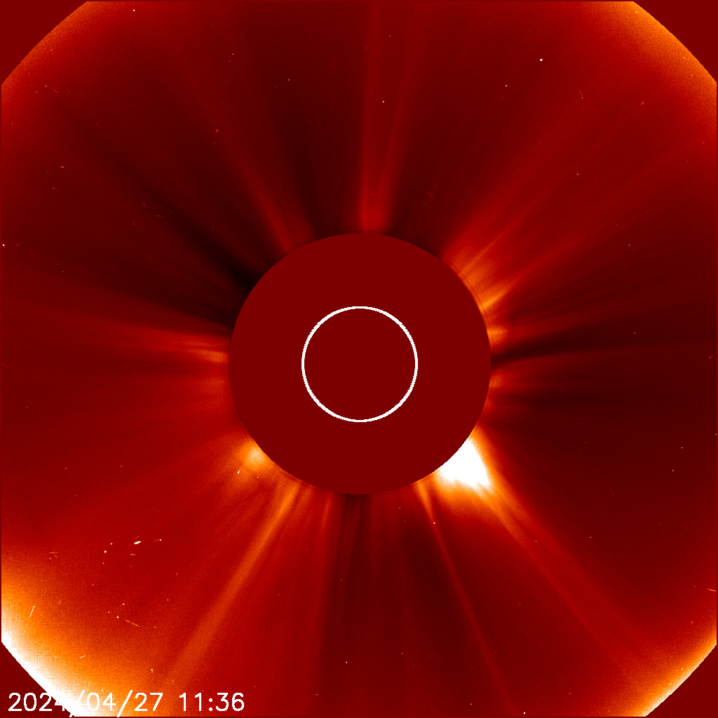
Im am gonna try to get another image or two of sun going dark tonight, but i think it wont happen this time.  day 4


last reported quake 730 pm eastern.  many hours have passed, not a single update.


 Magnitude 2.5+ Earthquakes Past Day

    3.119km WNW of Eutaw, Alabama2015-03-12 01:19:20 UTC10.8 km deep
    2.514km N of Ester, Alaska2015-03-12 00:43:39 UTC11.9 km deep
    4.523km E of Astara, Iran2015-03-12 00:42:33 UTC45.2 km deep
    4.452km E of Karpathos, Greece2015-03-12 00:39:22 UTC10.0 km deep
    2.726km NW of Larsen Bay, Alaska2015-03-11 23:25:02 UTC57.5 km deep
    4.547km WSW of Ashkasham, Afghanistan2015-03-11 19:14:37 UTC89.5 km deep
    4.9136km SSE of Raoul Island, New Zealand2015-03-11 18:53:23 UTC10.0 km deep
    4.337km W of Esso, Russia2015-03-11 18:06:58 UTC57.8 km deep
    4.8223km ESE of Lambasa, Fiji2015-03-11 18:02:15 UTC529.8 km deep
    2.729km SE of Valdez, Alaska2015-03-11 17:22:37 UTC19.7 km deep
    2.524km ENE of Cherokee, Oklahoma2015-03-11 16:49:00 UTC5.0 km deep
    2.518km NE of Cherokee, Oklahoma2015-03-11 16:47:21 UTC4.0 km deep
    2.618km NE of Cherokee, Oklahoma2015-03-11 16:42:05 UTC4.0 km deep
    2.992km W of Ferndale, California2015-03-11 16:32:46 UTC23.2 km deep
    5.489km W of Sardinal, Costa Rica2015-03-11 16:23:38 UTC20.9 km deep
    2.5115km SSE of Coldfoot, Alaska2015-03-11 15:46:30 UTC6.7 km deep
    2.622km E of Waukomis, Oklahoma2015-03-11 15:33:57 UTC5.5 km deep
    4.9124km WNW of Kota Ternate, Indonesia2015-03-11 14:46:33 UTC45.4 km deep
    3.319km S of Perry, Oklahoma2015-03-11 14:44:42 UTC4.9 km deep
    2.915km SE of Anthony, Kansas2015-03-11 13:05:38 UTC10.4 km deep
    4.9236km NW of Saumlaki, Indonesia2015-03-11 09:39:09 UTC158.4 km deep
    4.5167km SSE of Sinabang, Indonesia2015-03-11 09:12:00 UTC35.0 km deep
    4.6209km WNW of Saumlaki, Indonesia2015-03-11 08:51:41 UTC132.0 km deep

Real-time & Historical Earthquake Information

nuclear plants will fail, as we are killed off in the near future.  Vote OBAMA he is a world class looser...

Earthquakes
Significant Earthquakes Past 30 Days

    6.210km NE of Aratoca, Colombia2015-03-10 20:55:44 UTC157.4 km deep
    7.0131km N of Nebe, Indonesia2015-02-27 13:45:05 UTC552.3 km deep
    6.3140km E of Miyako, Japan2015-02-20 04:25:24 UTC13.5 km deep
    6.483km ESE of Lakatoro, Vanuatu2015-02-19 13:18:32 UTC10.0 km deep
    6.782km ENE of Miyako, Japan2015-02-16 23:06:28 UTC23.0 km deep
    6.232km ESE of Taitung City, Taiwan2015-02-13 20:06:31 UTC24.3 km deep
    7.1Northern Mid-Atlantic Ridge2015-02-13 18:59:12 UTC16.4 km deep
    6.7103km W of El Aguilar, Argentina2015-02-11 18:57:22 UTC223.0 km deep


here is another list of quakes

http://www.emsc-csem.org/Earthquake/

   2015-03-12   05:16:18.055min ago   20.61    S     70.73    W     22   3.7    OFFSHORE TARAPACA, CHILE
         2015-03-12   04:45:35.01hr 26min ago   37.03    N     31.00    E     114   2.6    WESTERN TURKEY
         2015-03-12   03:44:24.62hr 27min ago   36.52    N     27.08    E     7   2.3    DODECANESE IS.-TURKEY BORDER REG
         2015-03-12   02:51:08.03hr 20min ago   21.22    S     68.69    W     137   2.8    ANTOFAGASTA, CHILE
         2015-03-12   02:33:42.03hr 37min ago   34.19    S     73.48    W     25   3.5    OFF COAST OF O'HIGGINS, CHILE
         2015-03-12   02:18:43.03hr 52min ago   34.22    S     73.52    W     42   3.7    OFF COAST OF O'HIGGINS, CHILE
         2015-03-12   02:10:31.44hr 01min ago   35.76    N     97.39    W     8   2.4    OKLAHOMA
         2015-03-12   01:55:02.34hr 16min ago   32.88    N     96.91    W     8   2.4    NORTHERN TEXAS
         2015-03-12   01:48:28.04hr 23min ago   34.29    S     73.36    W     34   3.9    OFF COAST OF O'HIGGINS, CHILE
         2015-03-12   01:19:20.04hr 52min ago   32.94    N     88.07    W     11   3.1    ALABAMA
         2015-03-12   01:07:01.25hr 04min ago   35.97    N     24.72    E     28   2.1    CRETE, GREECE
         2015-03-12   01:04:07.75hr 07min ago   35.76    N     27.77    E     15   3.0    DODECANESE ISLANDS, GREECE
         2015-03-12   00:42:35.15hr 29min ago   38.47    N     49.21    E     61   4.9    CASPIAN SEA, OFFSHORE AZERBAIJAN
         2015-03-12   00:39:22.65hr 32min ago   35.47    N     27.80    E     10   4.4    DODECANESE ISLANDS, GREECE
         2015-03-12   00:00:36.56hr 11min ago   34.33    N     118.46    W     1   2.3    GREATER LOS ANGELES AREA, CALIF.

freethisone

Re: Ice Age Model
« Reply #388, on March 11th, 2015, 11:45 PM »Last edited on March 12th, 2015, 12:45 AM
what do ya know, .  day 4...


X2-FLARE AND RADIO BLACKOUT: All week long, sunspot AR2297 has been crackling with  M and X Class solar flares. Yesterday it produced a really big double super mega x class flare.. On March 11th at 16:22 UT (09:22 PDT), Earth orbiting-satellites detected an X2-class flare. The blast zone was larger than Earth tself:

Extreme ultraviolet radiation from the explosion ionized the upper layers of Earth's atmosphere, causing HF radio blackouts and other propagation effects on the dayside of our planet, particularly over the Americas: map.

In New Mexico, amateur radio astronomer Thomas Ashcraft was observing the sun using a wideband spectrograph when the flare occured. The radio blackout was obvious at every frequency from 15 MHz to 26 MHz:

"The X-flare scrambled the ionosphere thoroughly so that no decametric radio signals were supported in my part of the world," says Ashcraft. "The ionosphere started to reform after about fifteen minutes when stations began to reappear. (The stuff visible during the blackout was my own observatory electricity. Nothing exterior.)"

A coronal mass ejection (CME) was propelled into space by the explosion. However, we do not yet know if it will hit Earth. A glancing blow is possible on March 13th or 14th.


I added the m, and x class double whammy to reflect what is really happening..

freethisone

Re: Ice Age Model
« Reply #389, on March 12th, 2015, 12:37 PM »
what really happened?  this comes 1 day after earthquake report...

Event Description    
Translate
   
Share on facebook Share on twitter Share on email Share on print More Sharing Services 1

Explosion in USA on Thursday, 12 March, 2015 at 17:28 (05:28 PM) UTC.
Description
Authorities say one worker was killed and several others injured after multiple explosions at an industrial plant in Brent, southwest of Birmingham. The Tuscaloosa News reports that up to six other workers received chemical burns and were taken to nearby hospitals after the Wednesday afternoon explosions and fire at Brent Industries. The newspaper reports that a helicopter was used to fly one of the workers to a hospital. Police identified the worker who was killed as Keith Leverette. Brent Police Chief Terry Nichols said none of the burning chemicals posed a danger to the community. The cause of the blasts is unknown at this time. Flames consumed both the manufacturing and recycling plant. Brent is about 35 miles southeast of Tuscaloosa.

freethisone

Re: Ice Age Model
« Reply #390, on March 12th, 2015, 12:42 PM »
4   super storms update..

Tropical Storm Report
Storm name: Pam (17P)
Category: Cyclone V
Position date: 2015.03.12 19:29:05
Speed: Speed of 15 km/h to 145 degrees direction
Wind speed: 222 km/h
Gust speed: 269 km/h

Tropical Storm Report
Storm name: Olwyn (19S)
Category: Cyclone I
Position date: 2015.03.12 19:29:05
Speed: Speed of 22 km/h to 195 degrees direction
Wind speed: 120 km/h
Gust speed: 148 km/h


Tropical Storm Report
Storm name: Olwyn (19S)
Category: Cyclone I
Position date: 2015.03.12 19:29:05
Speed: Speed of 22 km/h to 195 degrees direction
Wind speed: 120 km/h
Gust speed: 148 km/h


Storm name: Bavi (03W)
Category: Tropical Storm
Position date: 2015.03.12 19:40:24
Speed: Speed of 15 km/h to 295 degrees direction
Wind speed: 65 km/h
Gust speed: 83 km/h

freethisone

Re: Ice Age Model
« Reply #391, on March 12th, 2015, 10:53 PM »Last edited on March 13th, 2015, 11:53 AM
data miss located  revised addition...

https://www.youtube.com/watch?v=HT91nzzuHtQ#ws

Tropical Storm Report
Storm name: Pam (17P)
Category: Cyclone V
Position date: 2015.03.13 18:25:33
Speed: Speed of 15 km/h to 195 degrees direction
Wind speed: 269 km/h
Gust speed: 324 km/h

that is 200 MPH gusts
167 mph sustained


holly cow...

Storm name: Bavi (03W)
Category: Typhoon I
Position date: 2015.03.13 18:25:33
Speed: Speed of 28 km/h to 295 degrees direction
Wind speed: 93 km/h
Gust speed: 120 km/h

Storm name: Olwyn (19S)
Category: Cyclone I
Position date: 2015.03.13 18:25:33
Speed: Speed of 31 km/h to 175 degrees direction
Wind speed: 120 km/h
Gust speed: 148 km/h

Tropical Storm Report
Storm name: Nathan (18P)
Category: Cyclone I
Position date: 2015.03.13 18:25:33
Speed: Speed of 4 km/h to 65 degrees direction
Wind speed: 102 km/h
Gust speed: 130 km/h


freethisone

Re: Ice Age Model
« Reply #392, on March 17th, 2015, 04:21 PM »Last edited on March 17th, 2015, 06:38 PM
6.7 or larger down graded


M6.6 - 134km NW of Kota Ternate, Indonesia
IV
DYFI?VI
ShakeMap GREEN
PAGER Tsunami Warning Center
Event Location
Data Source US3, AT1
Map showing extent (w,s,e,n) = (121.5231, -3.3422, 131.5231, 6.6578)1.658°N 126.523°E depth=41.7 kmView interactive map
Event Time

    2015-03-17 22:12:28 (UTC)
    2015-03-17 18:12:28 (UTC-04:00) in your timezone
    Times in other timezones

Nearby Cities

    134km (83mi) NW of Kota Ternate, Indonesia
    136km (85mi) NW of Ternate, Indonesia
    151km (94mi) E of Bitung, Indonesia
    165km (103mi) W of Tobelo, Indonesia
    1083km (673mi) SW of Koror Town, Palau


now i say interesting and if a great quake is produced it will be within 14 days.   but i wont hold my breath.. first week of July still stands as a 1 year old prediction..


i keep a close eye on may 5 2015,,

from last x class to 47 day observe in memory of 3-11.  and in just about 40 days a great quake is possible, or  a few large 7.0 leading to ANOTHER 40 DAYS WAITING ON 07-15

freethisone

Re: Ice Age Model
« Reply #393, on March 18th, 2015, 10:02 PM »Last edited on March 18th, 2015, 10:11 PM
as you see im human, and my last post was made to wrong thread...
 O:-)

freethisone

Re: Ice Age Model
« Reply #394, on March 19th, 2015, 01:38 PM »
List of latest earthquakes worldwide
(updated: 19 Mar, 20:17 UTC) (only quakes >=M.3.8) X


Thursday, 19 March 2015
Thu, 19 Mar 19:43:44 UTC M 5.2 / 10.0km - [info] East of Kuril Islands - [I felt it] 44.8000 / 151.5300 GFZ
Thu, 19 Mar 19:13:54 UTC M 4.2 / 185.0km - [info] CATAMARCA (Argentina) - [I felt it] -  -27.9560 / -66.7110 INPRES
Thu, 19 Mar 14:31:57 UTC M 4.2 / 16.0km - [info] TAJIKISTAN - [I felt it] 40.1700 / 69.2900 EMSC
Thu, 19 Mar 13:11:53 UTC M 4.2 / 21.0km - [info] OFF COAST OF TARAPACA, CHILE - [I felt it] -  -18.6100 / -71.2700 EMSC
Thu, 19 Mar 13:00:16 UTC M 4.4 / 530.0km - [info] Banda Sea - [I felt it] -  -6.9900 / 125.7100 GFZ
Thu, 19 Mar 12:07:20 UTC M 3.9 / 40.0km - [info] OFFSHORE BIO-BIO, CHILE - [I felt it] -36.0900 / -73.6800 EMSC
Thu, 19 Mar 11:52:01 UTC M 5.0 / 63.0km - [info] Peru-Ecuador Border Region - [I felt it] -  -3.2800 / -80.4800 GFZ
Thu, 19 Mar 11:39:29 UTC M 4.1 / 43.0km - [info] OFFSHORE BIO-BIO, CHILE - [I felt it] -36.1900 / -73.8200 EMSC
Thu, 19 Mar 10:58:16 UTC M 4.4 / 10.0km - [info] BURYATIYA, RUSSIA - [I felt it] 56.0500 / 113.8200 EMSC
Thu, 19 Mar 10:06:00 UTC M 5.2 / 39.0km - [info] Northern Molucca Sea - [I felt it] -  1.9700 / 126.4000 GFZ
Thu, 19 Mar 08:34:21 UTC M 5.0 / 16.0km - [info] Near Coast of Central Chile - [I felt it] -  -36.0700 / -73.5500 GFZ
Thu, 19 Mar 07:47:19 UTC M 4.8 / 10.0km - [info] MID-INDIAN RIDGE - [I felt it] -  -28.8900 / 73.9100 EMSC
Thu, 19 Mar 06:23:44 UTC M 4.7 / 581.0km - [info] Celebes Sea - [I felt it] -  3.3600 / 122.3500 GFZ
Thu, 19 Mar 05:54:19 UTC M 3.9 / 131.0km - [info] 67 km al NOROESTE de CINTALAPA, CHIS - [I felt it] 16.9100 / -94.3100 SSN
Thu, 19 Mar 04:57:04 UTC M 4.1 / 40.0km - [info] OFF EAST COAST OF KAMCHATKA - [I felt it] 53.7100 / 161.8500 EMSC
Thu, 19 Mar 04:41:04 UTC M 4.0 / 115.0km - [info] 138 km al SUROESTE de PIJIJIAPAN, CHIS - [I felt it] 14.8000 / -94.1200 SSN
Thu, 19 Mar 04:40:22 UTC M 4.0 / 44.0km - [info] OFFSHORE BIO-BIO, CHILE - [I felt it] -36.2600 / -73.7900 EMSC
Thu, 19 Mar 03:49:21 UTC M 5.1 / 10.0km - [info] South Sandwich Islands Region - [I felt it] -  -55.4200 / -28.4800 GFZ
Thu, 19 Mar 03:15:26 UTC M 5.2 / 40.0km - [info] 221km ENE of Petropavlovsk-Kamchatskiy, Russia - [I felt it] 53.5108 / 161.8711 USGS
Thu, 19 Mar 02:41:38 UTC M 3.9 / 23.5km - [info] 87 km al O de Cobquecura - [I felt it] -  -36.1120 / -73.7620 GUG (U. Chile)
Thu, 19 Mar 02:36:38 UTC M 4.1 / 32.0km - [info] OFFSHORE BIO-BIO, CHILE - [I felt it] -36.3100 / -73.8300 EMSC
Thu, 19 Mar 02:26:10 UTC M 3.9 / 38.0km - [info] 5 km al NORESTE de PINOTEPA NACIONAL, OAX - [I felt it] 16.3900 / -98.0400 SSN
Thu, 19 Mar 02:02:30 UTC M 4.2 / 43.0km - [info] OFFSHORE BIO-BIO, CHILE - [I felt it] -36.2300 / -73.8200 EMSC
Thu, 19 Mar 01:33:55 UTC M 4.7 / 60.0km - [info] Near East Coast of Honshu, Japan - [I felt it] -  38.5100 / 141.9200 GFZ
Thu, 19 Mar 01:33:09 UTC M 4.8 / 20.0km - [info] OFFSHORE BIO-BIO, CHILE - [I felt it] -  -36.1000 / -73.4300 EMSC
Thu, 19 Mar 01:15:13 UTC M 3.9 / 70.6km - [info] New Zealand - [I felt it] -41.3357 / 173.5895 GEONET (NZ)
Thu, 19 Mar 00:31:48 UTC M 3.9 / 15.0km - [info] 144 km al SUROESTE de CD HIDALGO, CHIS - [I felt it] 13.6200 / -92.9300 SSN
Wednesday, 18 March 2015
Wed, 18 Mar 23:42:13 UTC M 4.3 / 36.0km - [info] OFF COAST OF BIO-BIO, CHILE - [I felt it] -36.2000 / -74.2700 EMSC
Wed, 18 Mar 23:31:02 UTC M 4.5 / 10.0km - [info] Northern Algeria - [I felt it] - [reports] -  35.1100 / 5.6100 GFZ
Wed, 18 Mar 22:01:57 UTC M 4.7 / 29.8km - [info] 97 km al O de Cobquecura - [I felt it] - [reports] -  -36.0960 / -73.8720 GUG (U. Chile)
Wed, 18 Mar 21:56:37 UTC M 4.5 / 25.7km - [info] 105 km al O de Cobquecura - [I felt it] -  -36.0690 / -73.9570 GUG (U. Chile)
Wed, 18 Mar 21:08:43 UTC M 4.5 / 10.0km - [info] OFF EAST COAST OF HONSHU, JAPAN - [I felt it] 39.7800 / 143.9500 EMSC
Wed, 18 Mar 21:01:40 UTC M 4.1 / 25.0km - [info] OFFSHORE BIO-BIO, CHILE - [I felt it] -36.0700 / -73.7300 EMSC
Wed, 18 Mar 20:43:06 UTC M 4.4 / 39.7km - [info] 107 km al O de Concepción - [I felt it] -36.4060 / -74.1270 GUG (U. Chile)
Wed, 18 Mar 20:09:09 UTC M 4.5 / 27.8km - [info] 87 km al O de Cobquecura - [I felt it] -36.0430 / -73.7590 GUG (U. Chile)
Wed, 18 Mar 19:56:14 UTC M 5.0 / 69.0km - [info] Near Coast of Peru - [I felt it] -  -16.9200 / -72.9200 GFZ
Wed, 18 Mar 19:29:17 UTC M 4.8 / 14.0km - [info] OFFSHORE BIO-BIO, CHILE - [I felt it] -  -36.2300 / -73.7600 EMSC
Wed, 18 Mar 19:14:48 UTC M 4.0 / 20.0km - [info] 72 km al NORESTE de SANTA ROSALIA, BCS - [I felt it] 27.8900 / -111.8900 SSN
Wed, 18 Mar 19:07:52 UTC M 5.4 / 19.0km - [info] Near Coast of Central Chile - [I felt it] - [reports] -  -36.1100 / -73.3500 GFZ
Wed, 18 Mar 19:06:52 UTC M 4.5 / 252.4km - [info] 12km N of Takayama, Japan - [I felt it] -  36.2406 / 137.2754 USGS
Wed, 18 Mar 19:06:52 UTC M 4.5 / 258.0km - [info] EASTERN HONSHU, JAPAN - [I felt it] -  36.2700 / 137.3300 EMSC
Wed, 18 Mar 18:55:27 UTC M 4.2 / 17.0km - [info] 106 km al O de Cobquecura - [I felt it] -  -36.1570 / -73.9750 GUG (U. Chile)
Wed, 18 Mar 18:49:01 UTC M 4.4 / 13.0km - [info] 26 KM AL NORTE DE OTEAPAN, VER - [I felt it] - [reports] -  18.2400 / -94.6500 SSN
Wed, 18 Mar 18:27:31 UTC M 6.1 / 20.0km - [info] Near Coast of Central Chile - [I felt it] - [reports] -  -36.0700 / -73.2400 GFZ
Wed, 18 Mar 18:24:47 UTC M 4.2 / 44.0km - [info] PUERTO RICO REGION - [I felt it] -  19.5500 / -66.0500 EMSC
Wed, 18 Mar 16:54:43 UTC M 4.1 / 232.0km - [info] ANTOFAGASTA, CHILE - [I felt it] -  -23.4900 / -67.2500 EMSC
Wed, 18 Mar 16:34:42 UTC M 4.2 / 159.2km - [info] 36 km al O de Visviri - [I felt it] -  -17.6020 / -69.8250 GUG (U. Chile)
Wed, 18 Mar 15:35:21 UTC M 4.3 / 230.0km - [info] POTOSI, BOLIVIA - [I felt it] -  -21.4600 / -66.7100 EMSC
Wed, 18 Mar 15:14:05 UTC M 4.6 / 15.0km - [info] 66 km al SUROESTE de PINOTEPA NACIONAL, OAX - [I felt it] -  15.9100 / -98.4900 SSN
Wed, 18 Mar 15:08:06 UTC M 4.9 / 19.0km - [info] Irian Jaya Region, Indonesia - [I felt it] -  -1.0600 / 134.4100 GFZ
Wed, 18 Mar 12:03:42 UTC M 3.9 / 160.0km - [info] 27 km al SUR de MINATITLAN, VER - [I felt it] -  17.7500 / -94.6000 SSN
Wed, 18 Mar 11:59:06 UTC M 4.9 / 10.0km - [info] Eastern Siberia, Russia - [I felt it] -  62.6300 / 138.3400 GFZ
Wed, 18 Mar 06:15:22 UTC M 4.1 / 0.0km - [info] SE SETIF.ARG - [I felt it] - 

freethisone

Re: Ice Age Model
« Reply #395, on March 19th, 2015, 01:40 PM »
 
Volcano News - John Seach
February 2015

Monitoring worldwide volcanic activity
27 years of volcano adventures
15 years on the internet (2000-2015)


Reports are posted in Eastern Australian Time (UT +10 hr).
Archived Volcano News

See photos and video of John Seach flying Microlight aircraft

Tweets by @johnseach

Sunday 22nd February 2015
 Ambrym Volcano, Vanuatu
 A new eruption was reported at Ambrym volcano, Vanuatu on 21st February 2015. A new vent opened in the caldera and dense ash 8000 ft altitude. A lava flow was reported by pilots. If confirmed, the new lava flow is the first at Ambrym since 1989. Tourists and residents are advised of the danger near the active vents due to increased activity. The new eruption was preceded by a magnitude 6.4 earthquake 6 km south of Ambrym Island on 20th February 2015. The alert level at Ambrym is raised to 3 (out of maximum 4).
More on Ambrym Volcano...
Volcanoes of Vanuatu...

Wednesday 11th February 2015
 Home Reef Volcano, Tonga
 A new eruption of Home Reef Volcano, Tonga began on 10th February 2015. Steam cloud reached 6000 ft altitude.
More on Home Reef Volcano...
Volcanoes of Tonga...

Thursday 5th January 2015
 Piton de la Fournaise Volcano, Reunion
 An eruption of Piton de la Fournaise volcano, Reunion began on 4th February 2015. Lava was ejected 10 m high and lava flowed from a fissure on the SW side of the volcano.
More on Piton de la Fournaise Volcano...


Saturday 24th January 2015
 Kuwae Volcano, Vanuatu
 A magnitude 6.8 earthquake hit under Kuwae volcano, Vanuatu on 23rd January 2015. The focus was at a depth of 218 km.
More on Kuwae Volcano...
Volcanoes of Vanuatu...

Thursday 8th January 2015
 Soputan Volcano, Indonesia
 Eruptions of Soputan volcano began on 3rd January 2015. On 6th January ash emissions reached 27,000 ft. A 6.5 km exclusion zone was placed around the volcano and the alert level raised to RED.
More on Soputan Volcano...
Volcanoes of Indonesia...

Thursday 1st January 2015
 Hunga Ha'apai Volcano, Tonga
 Eruptions of Hunga Ha'apai undersea volcano, Tonga, began on 19 December 2014. Activity was reported by fisherman. Hunga Ha’apai is located 63 km away from the capital, Nuku’alofa. A white plume was visible from Kanokupolu coastline since 24 December.
More on Hunga Ha'apai Volcano...
Volcanoes of Tonga...

Thursday 1st January 2015
 Tangkubanparahu Volcano, Indonesia
 Tangkubanparahu volcano in west Java was raised to level 2 alert (waspada) on 31st December 2014 due to an increase in seismicity.
More on Tangkubanparahu Volcano...
Volcanoes of Indonesia...


Quick Links
Breaking News
World Volcanoes
Adventure Travel
Film and Television
Photos
Volcanology
Live Cams
Contact 

freethisone

Re: Ice Age Model
« Reply #396, on March 19th, 2015, 01:42 PM »
a record for safe keeping.


Worldwide Volcano News and Updates:

 
latest (Mar 2015) | Feb 2015 | Jan 2015 | archive

Volcanic activity worldwide 18 Mar 2015: Kliuchevskoi volcano, Raung, Sakurajima, Villarrica, Zhupanovsky

Wed, 18 Mar 21:00


Degassing plume from Klyuchevskoy this morning (KVERT)
Kliuchevskoi (Kamchatka): (18 Mar) Mild activity is again occurring at the summit vent of the tall stratovolcano. Aviation color code is orange.  ...more


 [read all]
Volcanoes Today, 18 Mar 2015: Kliuchevskoi volcano, Raung, Sakurajima, Villarrica, Zhupanovsky

Wed, 18 Mar 10:00


Zhupanovsky volcano (Kamchatka): new ash emission this morning

Wed, 18 Mar 09:17

Tokyo VAAC reports an eruption this morning that produced an ash plume at approx. 23,000 ft (7 km) altitude and extending NE.
More about Zhupanovsky volcano

Klyuchevskoy volcano (Kamchatka): increasing activity

Wed, 18 Mar 08:11


Degassing plume from Klyuchevskoy this morning (KVERT)
Mild activity is again occurring at the summit vent of the tall stratovolcano. Aviation color code is orange.  ...more

 More about Kliuchevskoi volcano


to top


Sakurajima volcano (Japan): frequent explosions

Wed, 18 Mar 08:08

The volcano remains in a very active phase with 5-10 daily explosions. An eruption on 16 March produced an ash plume to 14,000 ft (4.2 km) altitude, i.e. rising approx. 3 km above the Showa crater.
More about Sakurajima volcano

Villarrica volcano (Chile): volcano increases activity

Wed, 18 Mar 07:59


Mild strombolian activity at VIllarrica last night
Activity at the volcano is again increasing, which could again culminate in another paroxysm. Since 14 March, degassing and seismic activity have been observed to rise. Phases of mild strombolian activity appeared again on 16 March.  ...more

 More about Villarrica volcano

Raung volcano (East Java, Indonesia): alert level raised

Wed, 18 Mar 07:32


Strombolian activity in Raung's crater in late Feb 2015 (photo: Andi / VolcanoDiscovery Indonesia)
Strombolian activity continues from the vents inside the summit caldera of the volcano. Raung's alert level of the volcano was raised to 2 (on a scale of 1-4) a week ago.  ...more


 More about Raung volcano

Volcanic activity worldwide 16 Mar 2015: Shiveluch volcano, Reventador, Turrialba, Aso, Zhupanovsky

Mon, 16 Mar 15:55


Explosion at Shiveluch this afternoon (night in Kamchatka)
Shiveluch (Kamchatka): An explosion occurred a few hours ago. Webcam images show bright blow from incandescent material ejected. VAAC Tokyo estimates an ash plume was produced that rose to 25,000 ft (7.5 km) altitude.  ...more


 [read all]

to top


Turrialba volcano (Costa Rica) activity update

Mon, 16 Mar 15:55

The volcano has remained calm at the surface, but seismic activity continues to be elevated. According to OVSICORI-UNA, new explosions with strong ash emissions should be expected in the near future.
More about Turrialba volcano

Shiveluch volcano (Kamchatka, Russia): moderately strong explosion

Mon, 16 Mar 15:49


Explosion at Shiveluch this afternoon (night in Kamchatka)
An explosion occurred a few hours ago. Webcam images show bright blow from incandescent material ejected. VAAC Tokyo estimates an ash plume was produced that rose to 25,000 ft (7.5 km) altitude. More about Shiveluch volcano

Show more news


Aso volcano (Kyushu, Japan) activity update

Mon, 16 Mar 10:08


Weak strombolian eruption at Aso's Nakadake crater this morning
Weak strombolian activity from two vents continue at the Nakadake crater, accompanied by abundant steam and minor ash emissions. More about Aso volcano

Zhupanovsky volcano (Kamchatka): new ash emissions

Mon, 16 Mar 10:02


Ash plume from Zhupanovsky volcano this morning (NASA Terra/MODIS)
Intermittent phases of continuous mild to moderate ash emissions remain a frequent occurrence. This morning, an ash plume can be seen drifting approx. 40 km SW at an estimated altitude of 13,000 ft (4.2 km).  ...more

 More about Zhupanovsky volcano


to top


Reventador volcano (Ecuador): new lava flow ends

Mon, 16 Mar 09:49


Infrared image of Reventador volcano on 15 Mar (IGEPN)
The recent lava flow on the southwestern flank, that had started early on 11 March and had reached a length of approx. 1500 m, seems no longer to be active, or has decreased a lot. Occasional small explosions continue to occur at the summit vent.
 
Reventador on 11 March (IGPEN)
More about Reventador volcano

Volcanic activity worldwide 15 Mar 2015: Dukono volcano, Turrialba

Sun, 15 Mar 21:00


Turrialba volcano today
Dukono (Halmahera): A relatively large ash plume reaching 13,000 ft (4.2) km altitude was observed yesterday extending 50 km ENE (Tokyo VAAC).  ...more


 [read all]
Dukono volcano (Halmahera, Indonesia) activity update

Sun, 15 Mar 16:36

A relatively large ash plume reaching 13,000 ft (4.2) km altitude was observed yesterday extending 50 km ENE (Tokyo VAAC).
More about Dukono volcano

Turrialba volcano (Costa Rica): pause in activity, warning of new eruptions

Sun, 15 Mar 16:34


Turrialba volcano today
The volcano has remained calm for the past 36 hours, but OVSICORI-UNA warns that new explosions are likely in the near future.  ...more

 More about Turrialba volcano


to top


Volcanic activity worldwide 13 Mar 2015: Stromboli volcano, Fuego, Colima, Turrialba, Sangay

Fri, 13 Mar 17:51


Eruption of Colima around 1 am on 12 March (photo: Hernando Rivera)
Stromboli (Eolian Islands, Italy): Access to the summit area (accompanied by certified guides) has been re-opened, which means excursions to the Pizzo can again run as normal.  ...more


 [read all]
Fuego volcano (Guatemala) activity update

Fri, 13 Mar 17:48

The number and average size of explosions at the volcano have increased again since Wednesday. INSIVUMEH reported frequent explosions with shock waves and ash plumes of up to 1 km height. No lava flow is currently active.
More about Fuego volcano

Turrialba volcano (Costa Rica): strong ash eruptions

Fri, 13 Mar 17:37


Ash emission from Turrialba this morning (OVSICORI-UNA)
The volcano started to erupt again yesterday and has been producing an ongoing series of vigorous ash eruptions. The new activity followed 4 calm days after a few much weaker eruptions took place on 8 March.  ...more


 [read all] More about Turrialba volcano

Sangay volcano (Ecuador): mild activity in summit crater

Fri, 13 Mar 10:20

Mild eruptive activity, probably strombolian explosions, has been taking place at the summit crater of the volcano.  ...more

 More about Sangay volcano


to top


Show more news


Stromboli volcano (Eolian Islands, Italy): access to summit area re-opened, excursions resume

Fri, 13 Mar 09:47

Access to the summit area (accompanied by certified guides) has been re-opened, which means excursions to the Pizzo can again run as normal.  ...more

 More about Stromboli volcano

Colima volcano (Mexico): intermittent strong explosions

Fri, 13 Mar 09:37


Eruption of Colima around 1 am on 12 March (photo: Hernando Rivera)
The volcano continues to be highly active, producing intermittent explosions of various size.  ...more


 More about Colima volcano

Volcanic activity worldwide 12 Mar 2015: Santiaguito volcano

Thu, 12 Mar 21:00


Santiaguito (Guatemala): Join us on an exciting volcano expedition to visit 3 active volcanoes: Pacaya, Fuego, Santiaguito. The tour over the Holidays 2015-16 can now be guaranteed!  ...more

 
Volcanoes of Guatemala volcano tour 20 Dec - 2 Jan guaranteed

Thu, 12 Mar 11:33


Join us on an exciting volcano expedition to visit 3 active volcanoes: Pacaya, Fuego, Santiaguito. The tour over the Holidays 2015-16 can now be guaranteed! More about Santiaguito volcano


to top


Volcanic activity worldwide 11 Mar 2015: Reventador volcano, Sakurajima, Aso, Zhupanovsky

Wed, 11 Mar 21:00


Steam plume from Aso's Nakadake crater today
Zhupanovsky (Kamchatka, Russia): The volcano continues to produce intermittent weak to moderate ash emissions during the past weeks. Together with (far more active) Shiveluch and Karymsky volcanoes further north, there are currently 3 erupting volcanoes in Kamchatka.  ...more


 [read all]
Reventador volcano (Ecuador) activity update

Wed, 11 Mar 11:57


Thermal image of Reventador volcano today
Mild explosive and effusive activity in the form of a dome at the summit crater continue. Washington VAAC reported several small ash emissions and thermal images suggest that the lava flow on the upper western flank remains active. More about Reventador volcano

Aso volcano (Kyushu, Japan): activity decreases

Wed, 11 Mar 11:54


Steam plume from Aso's Nakadake crater today
Strombolian activity continues, but has decreased. Mostly, only a steam plume can be seen rising from the Nakadake crater, suggesting that explosive activity is now much lower than during the previous months. More about Aso volcano

Zhupanovsky volcano (Kamchatka, Russia) activity update

Wed, 11 Mar 11:44

The volcano continues to produce intermittent weak to moderate ash emissions during the past weeks. Together with (far more active) Shiveluch and Karymsky volcanoes further north, there are currently 3 erupting volcanoes in Kamchatka.
More about Zhupanovsky volcano


to top


Sakurajima volcano (Japan): intense strombolian activity

Wed, 11 Mar 11:41

The volcano continues to produce frequent strombolian to vulcanian-type explosions, often accompanied by long-lasting periods of ash emissions.  ...more

 More about Sakurajima volcano

Volcanic activity worldwide 9 Mar 2015: Fuego volcano, Kliuchevskoi, Soputan, Shiveluch, Turrialba, ...

Mon, 9 Mar 21:00


Explosion at Shiveluch yesterday morning
Kliuchevskoi (Kamchatka): The explosive-effusive eruption of the volcano probably finished.  ...more


 [read all]

freethisone

Re: Ice Age Model
« Reply #397, on March 29th, 2015, 07:34 PM »
Quote from freethisone on March 17th, 2015, 04:21 PM
6.7 or larger down graded


M6.6 - 134km NW of Kota Ternate, Indonesia
IV
DYFI?VI
ShakeMap GREEN
PAGER Tsunami Warning Center
Event Location
Data Source US3, AT1
Map showing extent (w,s,e,n) = (121.5231, -3.3422, 131.5231, 6.6578)1.658°N 126.523°E depth=41.7 kmView interactive map
Event Time

    2015-03-17 22:12:28 (UTC)
    2015-03-17 18:12:28 (UTC-04:00) in your timezone
    Times in other timezones

Nearby Cities

    134km (83mi) NW of Kota Ternate, Indonesia
    136km (85mi) NW of Ternate, Indonesia
    151km (94mi) E of Bitung, Indonesia
    165km (103mi) W of Tobelo, Indonesia
    1083km (673mi) SW of Koror Town, Palau


now i say interesting and if a great quake is produced it will be within 14 days.   but i wont hold my breath.. first week of July still stands as a 1 year old prediction..


i keep a close eye on may 5 2015,,

from last x class to 47 day observe in memory of 3-11.  and in just about 40 days a great quake is possible, or  a few large 7.0 leading to ANOTHER 40 DAYS WAITING ON 07-15
M7.5 - 55km SE of Kokopo, Papua New Guinea


VI
DYFI?

VII
ShakeMap

GREEN
PAGER
Tsunami Warning Center


Event Location

Data Source US3

Map showing extent (w,s,e,n) = (147.5556, -9.7599, 157.5556, 0.24009999999999998)
4.760°S 152.556°E depth=40.0 km
View interactive map


Event Time
2015-03-29 23:48:31 (UTC)
2015-03-29 19:48:31 (UTC-04:00) in your timezone
Times in other timezones


Nearby Cities
55km (34mi) SE of Kokopo, Papua New Guinea
281km (175mi) ENE of Kimbe, Papua New Guinea
310km (193mi) SE of Kavieng, Papua New Guinea
367km (228mi) WNW of Arawa, Papua New Guinea
787km (489mi) NE of Port Moresby, Papua New Guinea


Tectonic Summary

The March 29, 2015 M 7.5 earthquake southeast of Kokopo, Papua New Guinea, occurred as the result of thrust faulting on or near the plate boundary interface between the subducting Australia and overriding Pacific plates.  At the location of the earthquake, the Australia plate moves towards the east-northeast at a velocity of 105 mm/yr with respect to the Pacific plate, and begins its subduction into the mantle beneath New Britain and New Ireland at the New Britain Trench south of the earthquake. The moment tensor and depth of the event are consistent with thrust-type motion on the interface between these two plates. Note that at the location of the earthquake, some researchers divide the edges of the Australia and Pacific plates into several microplates that take up the overall convergence between Australia and the Pacific, including the Solomon Sea and South Bismark microplates local to this event. The Solomon Sea plate moves slightly faster and more northeasterly with respect to the Pacific plate than does Australia due to sea-floor spreading in the Woodlark Basin several hundred kilometers to the south of the March 29 earthquake, facilitating the classic subduction evident beneath New Britain and New Ireland.


The plate boundary between the Australia and Pacific plates in the Papua New Guinea region is very active seismically; 36 M 7+ events have occurred within 250 km of the March 29, 2015 earthquake over the past century. Few are known to have caused shaking-related fatalities because of the remoteness of the region, though a M 8.0 earthquake in November 2000 – one of three similarly sized events over a 2-day period – did cause several deaths. The largest nearby earthquake was an M 8.1 event, 70 km to the east of the March 29, 2015 earthquake, one of two M8+ earthquakes 140 km apart in July 1971.


Seismotectonics of the New Guinea Region and Vicinity
Map of Tectonic Summary Region
The Australia-Pacific plate boundary is over 4000 km long on the northern margin, from the Sunda (Java) trench in the west to the Solomon Islands in the east. The eastern section is over 2300 km long, extending west from northeast of the Australian continent and the Coral Sea until it intersects the east coast of Papua New Guinea. The boundary is dominated by the general northward subduction of the Australia plate.

Along the South Solomon trench, the Australia plate converges with the Pacific plate at a rate of approximately 95 mm/yr towards the east-northeast. Seismicity along the trench is dominantly related to subduction tectonics and large earthquakes are common: there have been 13 M7.5+ earthquakes recorded since 1900. On April 1, 2007, a M8.1 interplate megathrust earthquake occurred at the western end of the trench, generating a tsunami and killing at least 40 people. This was the third M8.1 megathrust event associated with this subduction zone in the past century; the other two occurred in 1939 and 1977.

Further east at the New Britain trench, the relative motions of several microplates surrounding the Australia-Pacific boundary, including north-south oriented seafloor spreading in the Woodlark Basin south of the Solomon Islands, maintain the general northward subduction of Australia-affiliated lithosphere beneath Pacific-affiliated lithosphere. Most of the large and great earthquakes east of New Guinea are related to this subduction; such earthquakes are particularly concentrated at the cusp of the trench south of New Ireland. 33 M7.5+ earthquakes have been recorded since 1900, including three shallow thrust fault M8.1 events in 1906, 1919, and 2007.

The western end of the Australia-Pacific plate boundary is perhaps the most complex portion of this boundary, extending 2000 km from Indonesia and the Banda Sea to eastern New Guinea. The boundary is dominantly convergent along an arc-continent collision segment spanning the width of New Guinea, but the regions near the edges of the impinging Australia continental margin also include relatively short segments of extensional, strike-slip and convergent deformation. The dominant convergence is accommodated by shortening and uplift across a 250-350 km-wide band of northern New Guinea, as well as by slow southward-verging subduction of the Pacific plate north of New Guinea at the New Guinea trench. Here, the Australia-Pacific plate relative velocity is approximately 110 mm/yr towards the northeast, leading to the 2-8 mm/yr uplift of the New Guinea Highlands.

Whereas the northern band of deformation is relatively diffuse east of the Indonesia-Papua New Guinea border, in western New Guinea there are at least two small (<100,000 km²) blocks of relatively undeformed lithosphere. The westernmost of these is the Birds Head Peninsula microplate in Indonesia's West Papua province, bounded on the south by the Seram trench. The Seram trench was originally interpreted as an extreme bend in the Sunda subduction zone, but is now thought to represent a southward-verging subduction zone between Birds Head and the Banda Sea.

There have been 22 M7.5+ earthquakes recorded in the New Guinea region since 1900. The dominant earthquake mechanisms are thrust and strike slip, associated with the arc-continent collision and the relative motions between numerous local microplates. The largest earthquake in the region was a M8.2 shallow thrust fault event in the northern Papua province of Indonesia that killed 166 people in 1996.

The western portion of the northern Australia plate boundary extends approximately 4800 km from New Guinea to Sumatra and primarily separates Australia from the Eurasia plate, including the Sunda block. This portion is dominantly convergent and includes subduction at the Sunda (Java) trench, and a young arc-continent collision.

In the east, this boundary extends from the Kai Islands to Sumba along the Timor trough, offset from the Sunda trench by 250 km south of Sumba. Contrary to earlier tectonic models in which this trough was interpreted as a subduction feature continuous with the Sunda subduction zone, it is now thought to represent a subsiding deformational feature related to the collision of the Australia plate continental margin and the volcanic arc of the Eurasia plate, initiating in the last 5-8 Myr. Before collision began, the Sunda subduction zone extended eastward to at least the Kai Islands, evidenced by the presence of a northward-dipping zone of seismicity beneath Timor Leste. A more detailed examination of the seismic zone along it's eastern segment reveals a gap in intermediate depth seismicity under Timor and seismic mechanisms that indicate an eastward propagating tear in the descending slab as the negatively buoyant oceanic lithosphere detaches from positively buoyant continental lithosphere. On the surface, GPS measurements indicate that the region around Timor is currently no longer connected to the Eurasia plate, but instead is moving at nearly the same velocity as the Australia plate, another consequence of collision.

Large earthquakes in eastern Indonesia occur frequently but interplate megathrust events related to subduction are rare; this is likely due to the disconnection of the descending oceanic slab from the continental margin. There have been 9 M7.5+ earthquakes recorded from the Kai Islands to Sumba since 1900. The largest was the great Banda Sea earthquake of 1938 (M8.5) an intermediate depth thrust faulting event that did not cause significant loss of life.

 More information on regional seismicity and tectonics


▸Downloads


Contributors
1.National Tsunami Warning Center (AT)
2.Pacific Tsunami Warning Center (PT)
3.USGS National Earthquake Information Center, PDE (US)

Additional Information
•About ANSS Comprehensive Catalog (ComCat)
•Technical Terms used on Event Pages


Questions or comments?

Facebook Twitter Google Email


General


day 22?

freethisone

Re: Ice Age Model
« Reply #398, on April 4th, 2015, 07:29 PM »Last edited on April 4th, 2015, 07:31 PM


the spark gap is triggered.

just look at that cme.

the sun is set on fire with massive filaments set to break loose in the following week,to 2 weeks.
Solar activity X class flair predictions 70 percent . 48 hours.
powerful 6.4 plus plus quakes loom over the horizon. 7.0 or better 70 percent chance 3 to 4 weeks.
 volcanic eruption on a large scale will follow.. set in motion. more super storms or cyclones.. O:-)

freethisone

Re: Ice Age Model
« Reply #399, on May 6th, 2015, 06:06 PM »
Quote from freethisone on March 17th, 2015, 04:21 PM
6.7 or larger down graded


M6.6 - 134km NW of Kota Ternate, Indonesia
IV
DYFI?VI
ShakeMap GREEN
PAGER Tsunami Warning Center
Event Location
Data Source US3, AT1
Map showing extent (w,s,e,n) = (121.5231, -3.3422, 131.5231, 6.6578)1.658°N 126.523°E depth=41.7 kmView interactive map
Event Time

    2015-03-17 22:12:28 (UTC)
    2015-03-17 18:12:28 (UTC-04:00) in your timezone
    Times in other timezones

Nearby Cities

    134km (83mi) NW of Kota Ternate, Indonesia
    136km (85mi) NW of Ternate, Indonesia
    151km (94mi) E of Bitung, Indonesia
    165km (103mi) W of Tobelo, Indonesia
    1083km (673mi) SW of Koror Town, Palau


now i say interesting and if a great quake is produced it will be within 14 days.   but i wont hold my breath.. first week of July still stands as a 1 year old prediction..


i keep a close eye on may 5 2015,,

from last x class to 47 day observe in memory of 3-11.  and in just about 40 days a great quake is possible, or  a few large 7.0 leading to ANOTHER 40 DAYS WAITING ON 07-15
what do you know ice age model hit a 7.5 on may 5th wow...


3000 km
2000 mi
46.317°S : 36.562°W
Earthquake Age

    Hour
    Day
    Week
    Older

Search Results
38 earthquakes - DownloadUpdated: 2015-05-07 01:04:05 UTCShowing event times using UTC38 earthquakes in map area

    7.5 130km SSW of Kokopo, Papua New Guinea 2015-05-05 01:44:05 UTC 42.0 km
    6.8 106km SSW of Kokopo, Papua New Guinea 2015-05-01 08:06:04 UTC 57.0 km
    6.7 125km SSW of Kokopo, Papua New Guinea 2015-04-30 10:45:05 UTC 48.9 km
    6.1 24km SSE of Ndoi Island, Fiji 2015-04-28 16:39:39 UTC 579.4 km
    6.7 19km SSE of Kodari, Nepal 2015-04-26 07:09:10 UTC 17.3 km
    6.6 49km E of Lamjung, Nepal 2015-04-25 06:45:21 UTC 14.6 km
    7.8 34km ESE of Lamjung, Nepal 2015-04-25 06:11:26 UTC 15.0 km
    6.2 182km WSW of Bella Bella, Canada 2015-04-24 13:56:16 UTC 10.0 km
    6.1 61km NW of Kaikoura, New Zealand 2015-04-24 03:36:42 UTC 52.0 km
    6.3 158km SSE of Lata, Solomon Islands 2015-04-22 22:57:15 UTC 72.0 km
    6.1 72km SW of Yonakuni, Japan 2015-04-20 12:00:00 UTC 29.0 km
    6.0 70km SW of Yonakuni, Japan 2015-04-20 11:45:13 UTC 29.0 km
    6.4 64km SE of Su'ao, Taiwan 2015-04-20 01:42:58 UTC 29.0 km
    6.5 183km SSW of Sigave, Wallis and Futuna 2015-04-17 15:52:51 UTC 10.0 km
    6.0 52km E of Palaikastron, Greece 2015-04-16 18:07:42 UTC 20.0 km
    6.3 105km NE of Hihifo, Tonga 2015-04-07 00:46:21 UTC 30.0 km
    6.0 65km SSE of Kokopo, Papua New Guinea 2015-03-31 12:18:24 UTC 39.0 km
    6.5 99km ENE of Hihifo, Tonga 2015-03-30 08:48:26 UTC 15.5 km
    6.4 109km NE of Hihifo, Tonga 2015-03-30 08:18:00 UTC 11.5 km
    6.0 94km NE of Hihifo, Tonga 2015-03-30 07:56:53 UTC 10.0 km
    7.5 53km SE of Kokopo, Papua New Guinea 2015-03-29 23:48:31 UTC 41.0 km
    6.4 45km ESE of Putre, Chile 2015-03-23 04:51:38 UTC 130.0 km
    6.2 75km NNW of Talcahuano, Chile 2015-03-18 18:27:29 UTC 13.0 km
    6.2 135km NW of Kota Ternate, Indonesia 2015-03-17 22:12:28 UTC 44.0 km
    6.1 70km NW of Luwuk, Indonesia 2015-03-15 23:17:16 UTC 31.0 km
    6.2 9km NNE of Aratoca, Colombia 2015-03-10 20:55:44 UTC 155.0 km
    6.1 48km NW of Sikabaluan, Indonesia 2015-03-03 10:37:30 UTC 28.0 km
    7.0 130km N of Nebe, Indonesia 2015-02-27 13:45:05 UTC 552.1 km
    6.2 217km SW of Tomatlan, Mexico 2015-02-22 14:23:12 UTC 5.0 km
    6.0 133km E of Miyako, Japan 2015-02-21 10:13:53 UTC 7.0 km
    6.2 141km E of Miyako, Japan 2015-02-20 04:25:23 UTC 10.0 km
    6.4 85km ESE of Lakatoro, Vanuatu 2015-02-19 13:18:32 UTC 10.0 km
    6.1 187km W of Lata, Solomon Islands 2015-02-18 09:32:26 UTC 10.0 km
    6.7 83km ENE of Miyako, Japan 2015-02-16 23:06:28 UTC 23.0 km
    6.2 146km NNW of Visokoi Island, South Georgia and the South Sandwich Islands 2015-02-16 22:00:53 UTC 13.0 km
    6.2 31km ESE of Taitung City, Taiwan 2015-02-13 20:06:32 UTC 30.0 km
    7.1 Northern Mid-Atlantic Ridge 2015-02-13 18:59:12 UTC 16.7 km
    6.7 102km W of El Aguilar, Argentina 2015-02-11 18:57:22 UTC 223.0 km

Didn't find what you were looking for?